Einsatzmöglichkeiten von Talsim-NG/en: Unterschied zwischen den Versionen
(Übernehme Bearbeitung einer neuen Version der Quellseite) |
(Die Seite wurde neu angelegt: „====Gridded or watershed oriented approach==== Talsim-NG can be used for both gridded or watershed oriented concepts <gallery mode="packed" heights=300px> File:Gridded model approach.png|gridded File:Hru.png|watersheds </gallery>“) |
||
| Zeile 53: | Zeile 53: | ||
====Atmosphere / Vegetation / Soil Interface for Crop Water Requirements and Irrigation==== | ====Atmosphere / Vegetation / Soil Interface for Crop Water Requirements and Irrigation==== | ||
[[Einzugsgebiet]] | [[Special:MyLanguage/Einzugsgebiet|Sub-basin]] | ||
====Linkage of flow components==== | ====Linkage of flow components==== | ||
Aktuelle Version vom 26. Januar 2024, 12:23 Uhr
Talsim-NG is the right tool for many different tasks:
- Rainfall-runoff simulations (both flood and long-term scenarios)
- River basin modelling and management
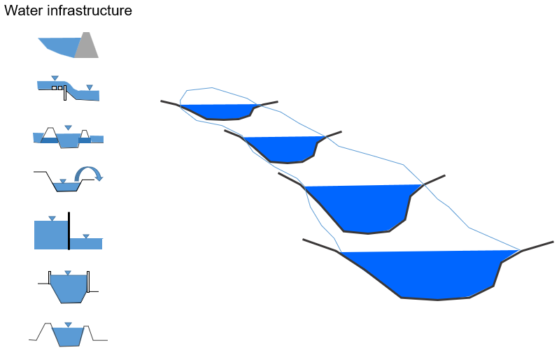
- Management of reservoirs, flood control reservoirs, dams or dam systems for various uses (water supply, flood protection, low flow augmentation, energy production, compliance with minimum releases, recreational use)
- Water quality simulations
- Coupling of water quantity and water quality considerations
- Dimensioning of water resource management facilities
- Operational use of Talsim-NG for water management in connection with a monitoring system
Talsim-NG includes the necessary tools for water resource analyses:
- Time series management
- Management of simulations and their results including result comparison
- Long-term simulations / short-term forecasts
- Request and output of arbitrary state variables
- Calculation of useful parameters such as balance values or probabilities
Process-based hydrological modelling
Processes and features:
- Precipitation-runoff component + snow compaction
- Soil moisture and crop water requirements calculation
- Up to 6 soil layers
- Snow simulation
- Hybrid hydrological/hydraulic flood routing
- Non-linear atmosphere-vegetation-soil interface
- Hybrid hydrological/hydraulic flood routing,
- Hydraulic modelling of weirs, diversions, pipes
- Crop water requirements
- Irrigation
- Reservoir operation
- Water quality
- Hydropower
- Conceptual groundwater modelling
- Nested modelling of sub-basins with high spatial resolution
- Generic rule builder for water management options
- Pre-processing and post-processing
- Multicriteria optimization
- Time series manager
- Project and scenario manager
- Client-Server architecture
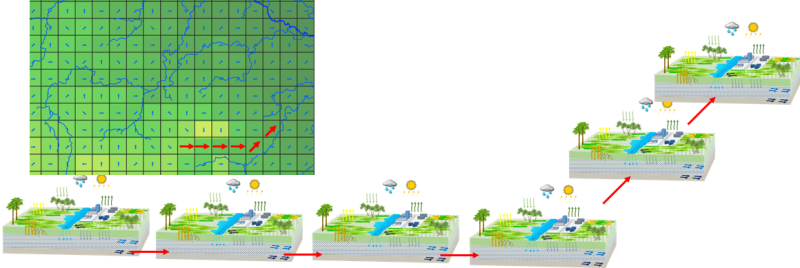
Gridded or watershed oriented approach
Talsim-NG can be used for both gridded or watershed oriented concepts
Atmosphere / Vegetation / Soil Interface for Crop Water Requirements and Irrigation
Linkage of flow components
Surface and sub-surface flow components between elements are interconnected. If soil downstream is saturated, flow from the upstream cell is impeded:
- Backwater effects
- Surface flow accumulates from element to element
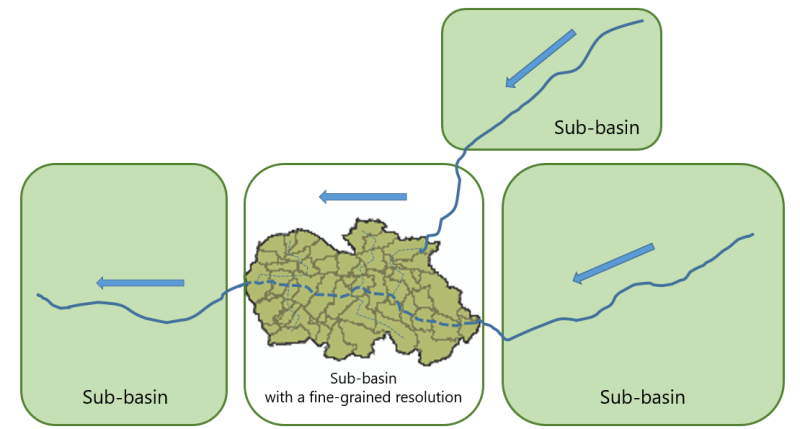
Nested modelling
A model within a model!
If necessary, sub-basins can be simulated with different resolutions and levels of detail within a large river basin model.
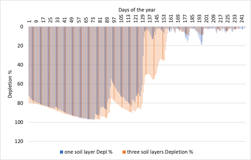
Crop water requirements
Comparison CropWat (FAO) vs. Talsim-NG
Hybrid hydrological / hydraulic modelling
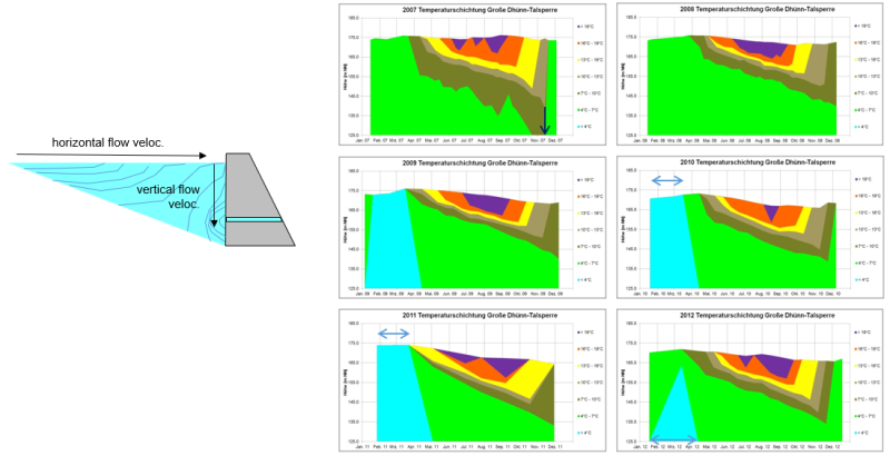
Water quality and stratification modelling
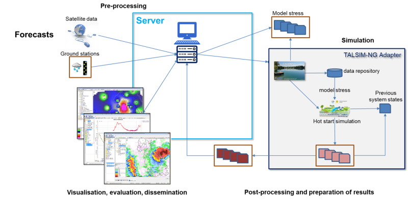
Talsim-NG in operational mode
Automation from data retrieval to sending e-mails when operational simulation runs are required
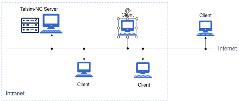
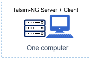
Client-Server environment
Emulated Client-Server environment
Emulated client-server environment Client and Server run on the same computer
Participatory modelling / serious gaming
Talsim-NG as tool for capacity building:
1) Topic: Live interaction between water managers
2) Tool: Put operators in various positions
- upstream perspective, downstream perspective
- exposes stakeholders to different levels of dependencies
- shows effects with/without data sharing
- demonstrates effects with/without cooperation
- mimics flood / drought events
3) Activity: A group of water managers plays at the same time
